F I R S T P R E V550NEXTLAST
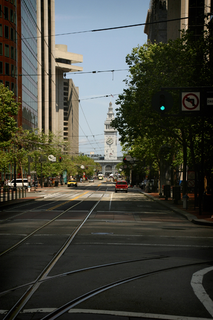
Moving Shoreline, Market Street
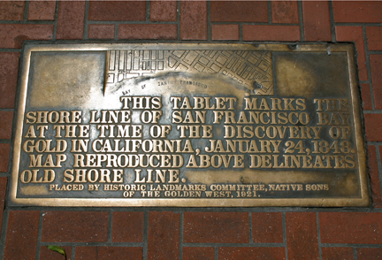
In the photo at the top you'll see the Ferry Building in the distance, behind it is the Bay. What is remarkable about this scene is that in 1848 the shoreline used to extend to the spot where this photo was taken. The plaque at the bottom marks the shoreline's old position. The landfill that extended the city was made up of hundreds of abandoned ships that littered the harbor during the Gold Rush. Without crews to man them the ships were broken down and incorporated into what is now the downtown area. In addition, the area's sand dunes, as high as 190 feet, were graded and served to fill in around the ships to build San Francisco's widest and grandest thoroughfare, Market Street.
[
MAP G-15 ]